 Bing has seen many changes recently. If you take a look at a Bing map in Streetside view today, you will come to see some changes that Microsoft has made at street-level images in Bing’s Maps search engine. These changes basically made for desktop browsers, help you take a wide look down the street to find out what all is over there, so that you don’t miss any view. With this wide surrounded look, we may view all locations and landmarks up and down the road.
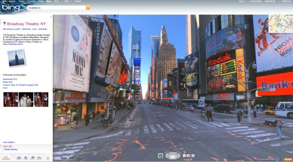
The Bing Blog says that this new view has to provide a lot of features.
- Adds smooth left/right panning navigation that makes it easy to find what’s nearby more quickly.
- While moving around in this new view you can track your position by looking at the street map above the imagery.
- you can also view the things across the street. This can be done by clicking the “u-turn” icon next to the street name in the upper left of the image.
- View of the sidewalk is seamlessly constructed including an overlay of business listings, street names and store fronts.
Microsoft’s research unit Street Slide takes care of the development of the desktop browsers.
The enhanced ground-level images have proved to be useful to the users (mainly include drivers, pedestrians etc.) as they want more detailed information of the locations- more generally driving directions. Both Google and Bing have been regularly experimenting with the street level map images to make them more informative.